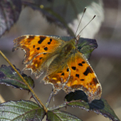
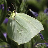
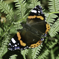
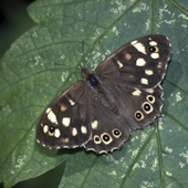
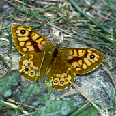
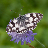
Vannesids |
|
 |
 |
 |
 |
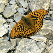
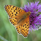
Fritillaries |
 |
 |
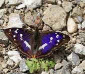 |
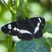
Admirals and Emperors |
 |
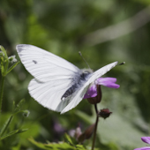
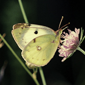
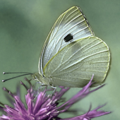
Whites |
_.jpg) |
 |
 |
 |
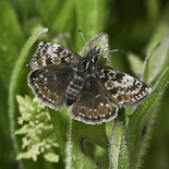
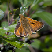
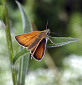
Skippers |
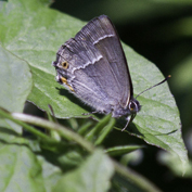
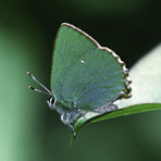
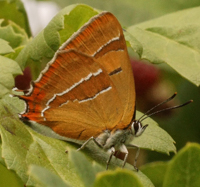
Hairstreaks |
|
 |
 |
 |
 |
 |
 |
 |
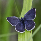
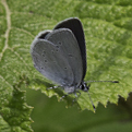
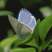
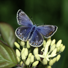
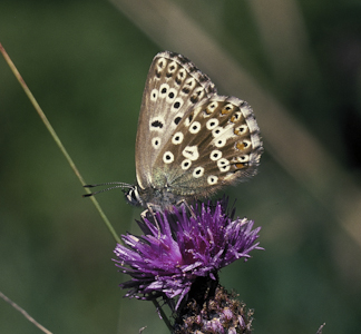
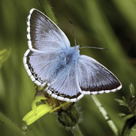
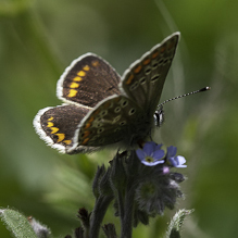
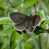
Blues
|
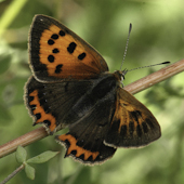
Copper |
 |
 |
 |
 |
 |
-6.jpg) |
 |
 |
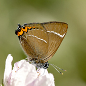
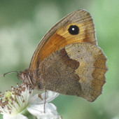
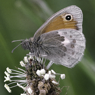
Small Heath Brown Hairstreak
|
|
 |
 |
 |
 |
 |
 |
 |
Submit Your Records & Comments Here
<-Click on images->
Welcome To The London Butterfly Survey
Map of area covered for records
1976-2023
This survey is a personal snapshot of arguably the most critical period in the natural history of Britain since the last ice age. The study comes from thousands of individual records, many of which are represented here. A simple system of abbreviations is used to define the areas under study - which by the nature of butterflies is often loosely defined. Precise map locations and logged charts support the records where possible. I am a Londoner by birth and have always lived and studied butterflies in the areas this study covers. I do not pretend that the survey is wholly scientific in the way of modern methodology. For instance, I prefer to use area references rather than TQ, which I find too exclusive. Also, unlike my peers of the 1960's and 1970's, my interest does not grow from a study of lepidotera and collecting, which I despise, but from photography and the aesthetics of butterfly form. This has obviously led to a greater knowledge of my subject, but like most of us, I am still learning about butterflies. The website provides my* realtime record of the butterfly life in 'our' area, but I am gratified and welcome the discourse that such social media platforms as Facebook and Twitter X promote, where records and images can be shared, enhancing the love, study and understanding of our treasured butterflies.
Map of area covered for records
If a rough triangular segment of the map of South London and Kent is taken, it will encompass the environs of Grove Park, then East to Sidcup through to Dartford Heath, including Joydens Wood and Wilmington. Then moving South West it encompasses Swanley Village, Horton Kirby, Eynsford, Lullingstone, Shoreham and Otford/Kemsing. This is its extent - the line then moves West along the M25 to encompass Poll Hill, then North to Pilots Wood, Andrews Wood, Badgers Mount, High Elms, Keston, Hayes and then Bromley Common. More recently, areas closer to Central London and the Thames
Recorded areas are defined as abbreviations:
BC - Bromley Common, including Bickley, Hook Farm, The Rookery and Elmfield. Ha-Hayes, including Hayes Farm and all areas towards Hayes Common and Keston. BN-Bromley North, including Grove Park and Downham. HE - High Elms country park and environs. Ey-Eynsford, including Lower and Upper Austin Lodge, Preston Hill and the Rifle Range. WH - White Hill Shoreham, including FAC Fackenden Down and areas East of Shoreham Village towards Otford telephone exchange. Orp-Orpington, including Ruxley Reserve, Hobblingwell and Petts Wood. Lu - Lullingstone, including Golf course and surrounding areas and villages. AW - Andrews Wood, Pilots Wood, Badgers Mount and all the adjacent areas to the West and North West of Shoreham Village. Other areas continue to be included and though a chore to localise to landmarks - TQ map, GPS, or nearest places are also acceptable if submitting records.
Decline of butterflies and invertebrates
The mid 1960's garden standard of nectaring small tortoiseshells and late season red admirals feasting on rotting plums seems to have confirmed a healthy diagnosis for our local invertebrate population. At least it seemed to be so to one such as I not then directly involved with conservation. This was to change, both for me personally and for the nature that became so much part of my life. For me from 1976/87 it was a matter of direct invovement with the butterflies populating the estate lands of the former Lord Dunsany. Contrast this extensive work, with thousands of personal records, site visits and scrub clearance, with the disasterous general diagnosis twenty years on of Eric Philp's mid 1990's Kent Butterfly Survey. I cannot say his study for the Kent Field Club was entirely applicable to my experience in the 1990's, but there were definite correlatives. These arose through direct observation, as I lived on a farm in Eynsford at the Eastern end of my study area. During this period the main causes of butterfly and invertebrate decline showed a clear correlation, not just between modern farming practices, but in particular the use of nicotine based pesticide. Between 1988 and 2000, in this one area alone, I observed a dramatic decline in invertebrates and in all dependent species, such as birds, reptiles and amphibians. This decline cannot be overstated and although there were localised issues that hastened this disaster, the facts seem to point directly at pesticide use and overspray. However, in areas set aside for butterflies, such as Shoreham, White Hill, Fackenden and most of the adjacent downland the picture is much brighter. Even here though, what can only be described as Victorian type agricultural attitudes still prevail among some local farmers, where conservationists are seen as some sort of alien intruders on 'their land' (which it is not). Also, and despite explicit notices stating the sensitivity of butterfly land, one can occasionally find delusional individuals that imagine walking gun dogs, where birds nest and reptlles breed, is an ok activity (which it is not).
Domestic and non agricultural land use
Gardeners have as much a duty to preserve wildlife as do conservationists, but the temptations of modern garden centres are far to strong in what they offer as a way of making the hard job of gardening seem an easy task. This includes the use of pesticides and soil enhancers and tools that help the eradication of any foreign impediment to the desired goal of making and preserving a pretty garden. Worse though, they breed the idea that it is acceptable, as a right of ownership, that householders can destroy anything that obstructs their intended goal. This is something of a post war legacy of affluency and it is unsurprising that the bright lights and perfect layouts touted by garden centres appeal to a particular age group. in many cases though there is now a realisation that something has to be done by the individual for the preservation of wildlife and as a plea to these gardeners, I would suggest any small (or bigger) patch left to run wild will help the cause. Education and the will to override the twin evils of ignorance and prejudice is imperative, but unfortunately, among many related to land management and I mean those who wield the tools as well as the power, there is a pitiable lack of direct knowledge and a far too ready tendency just to pay lip service to conservation. Worse still, are those that practice out of date and illegal actions under the cloak of landowner privacy and ignorance of modern conservation law.
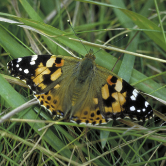
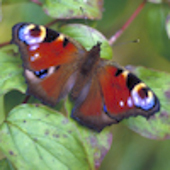
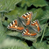
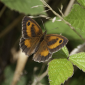
Images
All of the images have been produced as close as possible to the actual scale of the butterflies
Emergence and Climate Change
First emergence dates is a guide to the identification of butterflies in the field. Over a long period it also provides a guide to the changing patterns of butterfly activity.
*David Davis, Howard Walmsley, Nick Davey, Fred O Hare Jeff Boswell, Colin Slater. Thanks also to Steven, Martin and Mike
© Rodney Compton
* butterflies that show extended range or prevalence have been updated to 2023.


scale variation 25mm to 60mm approx